In Swedish »

Hiking in and around Östersund

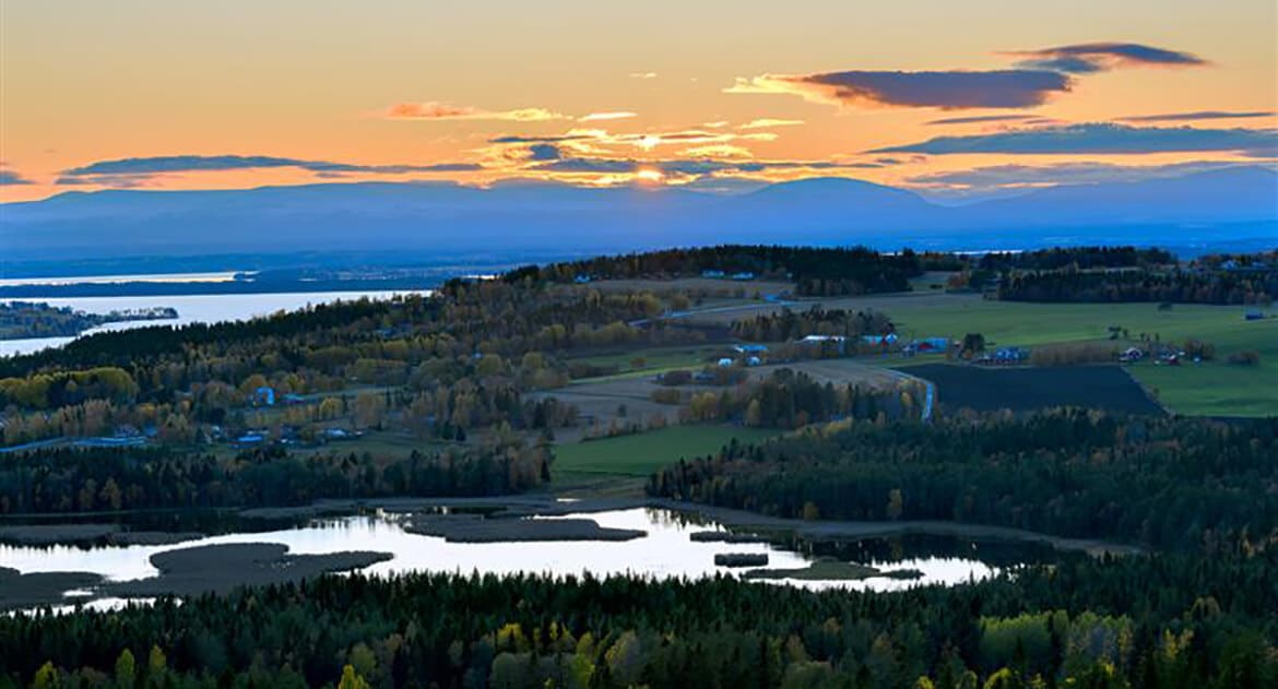
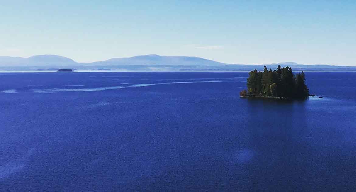
To have nature close and be able to experience it fully, without everyday demands and stress. Here at the lake Storsjön the mountains are always present and give beautiful views and tranquility.

In the areas of Östersund and Frösön there are many nice places for hiking, where you have both water and forest close by. Pack a backpack with plenty of picnic food and something that quenches thirst, so you can be out and enjoy a whole day.

Hikes at Frösö Island

On Frösö Island there are many nice trails and paths to explore. Since Frösö island is very hilly and located in Storsjön, you get nice and mile-long views along the way.

Mjällestigen

The path is 2.5 km long and runs mostly on roads and easy paths. The part over Öneberget, with the ancient castle, has a terrain that is partly steep.

at the steep descent from the mountain there are stairs and handrails.

Start where parking spaces are marked on the map and feel free to walk the path clockwise.
The path tells about Frösö Island important role during the Iron Age, but also something about nature and what may be hidden in Lake Storsjön.

Find your way here with the Nature Map Östersund

Härke stig

Stengårdsstigen

The path is just over 3 km long and mainly easy to walk. At Frösö camping it is good to start your walk.

From the reception you go down to the lower part of the campsite, where you come across the marked path.

Stengårdsstigen goes down the hill to one of Frösö Island most preserved village roads, where you can read about the farm Mickelsgård and Vallsundet ferry terminal.
The path tells about Frösön during the last centuries but also about ancient remains from the Iron Age.

Find your way here!

Stiglöpning Frösön

Östbergets nature trail

The nature trail is 1.7 km long and is excellent for the exercise round or for a shorter weekend excursion with coffee.

It starts at the car park at the top of the new entrance at Utsiktstornet. There is space to park both cars and bicycles.

In winter there is also a cross-country track with electric lighting of 2.2 km, see cross-country skiing. At the start there is an information board about the trail and after the trail there are information boards where you can learn more about the nature of Jämtland.
During the summer season there is a café nearby and the opportunity to get up and look at the view through binoculars at the lookout tower.

The trail goes through a hilly forest landscape. It is good to have boots, as the trail can be a bit wet and with some roots on the path. At the end of the trail there is also an old catch pit for catching animals and a nice vantage point with a coffee table, where you can eat your own lunch.

Find youre way here with the Nature Map Östersund

Kyrkstigen

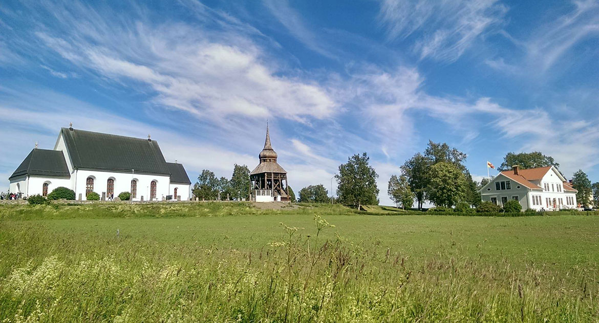
At Frösö Church there is a path that has been named the church path, it runs on well-trodden ground and on roads. The path is 3 km long and easy to wa

At Frösö Church there is a path that has been named the church path, it runs on well-trodden ground and on roads.
The path is 3 km long and easy to walk. At Frösö church there is a car park and it is a natural start for the path, but also at Sommarhagen it is possible to park and start the walk.
The path tells about Frösö church and about the history of the farm Hov, which dates back to the Iron Age more than 1000 years ago. Petersons-Bergers Sommarhagen is passed and on to Arnljotlägden, which is the venue for the drama Arnljot every year in July.

Frösö skans

At Kungsgårdsviken is Frösö skans. A 150 m long footpath leads down to Frösö skans. Skansen has its history during the 17th century.

At Kungsgårdsviken is Frösö skans. A 150 m long footpath leads down to Frösö skans.

Skansen has its history during the 17th century. During this century, several wars were fought between Sweden and Denmark-Norway.

The fort was besieged on two occasions and had to give up against Danish / Norwegian troops.
In 1645, Jämtland was handed over to Sweden at Frösö skans.

Turn left 500 m after Stocketitt and go 1100 m to a parking lot on the left side before Kungsgården.

Google maps

Bynäset

At beautiful Bynäset you can walk, run, cycle around the peninsula on a distance of about: 7 km. Walk around and enjoy the scenic s

You can find Bynäset on Frösön at Cronstadsväg. When you have passed Frösö Park Hotel, you will find a sign with Bynäset some metres away and there you turn left down towards the water.
Here you will find nice beaches that are found both on the north and south of the peninsula. In popular terms, this area is called “Östersund Riviera”.
The north side offers a long black sand beach, sandy bottom and open grass areas for play and picnics. In the summer there is also a small kiosk open- Västbyviken.

When you feel warm you can take a dip in the lake by the beach. The area is protected because it was previously a military exercise area. The view is something extra special with the sight of Åreskutan and Oviksfjällen.

Googlemaps!

Mjällestigen

The path is 2.5 km long and runs mostly on roads and easy paths. The part over Öneberget, with the ancient castle, has a terrain that is partly steep.

Show more

Härke stig

Stengårdsstigen

The path is just over 3 km long and mainly easy to walk. At Frösö camping it is good to start your walk.

Show more

Östbergets nature trail

The nature trail is 1.7 km long and is excellent for the exercise round or for a shorter weekend excursion with coffee.

Show more

Kyrkstigen

At Frösö Church there is a path that has been named the church path, it runs on well-trodden ground and on roads. The path is 3 km long and easy to wa

Show more

Frösö skans

At Kungsgårdsviken is Frösö skans. A 150 m long footpath leads down to Frösö skans. Skansen has its history during the 17th century.

Show more

Bynäset

At beautiful Bynäset you can walk, run, cycle around the peninsula on a distance of about: 7 km. Walk around and enjoy the scenic s

Show more

Nature reserve

In Östersund there are plenty of nature reserves and in Jämtland County there are 219. Nature reserves are the most common way of protecting valuable nature in the long term. It can be about preserving valuable natural areas, biodiversity and for people’s outdoor life. We are lucky to experience and stay in these areas, so show consideration for nature. The smaller imprint we leave behind, the better for everyone.

Ändsjön

At Frösön lies the nature reserve Ändsjön which is Frösön’s only lake. The lake is surrounded by both agricultural land and residential areas.

Ändsjön is a very shallow lake and a perfect place for many sea birds. Around the lake there is a path that is tracked over some of the parties and some information signs. The path is about 2.5-3 km long and passes past the two bird towers set in the reserve.

Find your way to Ändsjön here: space is located at Frösö Skidlek and at Vallaleden where you can start your hike. City buses No. 4 and No. 9 also take you here.

cykla

Andersön

Andersön is a popular place were families, exercisers and others who would like to recharge their batteries and calm down for a while goes.

The island is a nature reserve and the environment here is, to say the least, fascinating.
Long beautiful rocky beaches, knotty pines, ancient monuments and fossils.

In the forest there is a myriad of forest paths for anyone who wants to jog, cycle, stroll or pick mushrooms and berries.
Along the beaches there are plenty of nice barbecue areas right next to the water. Last summer’s heat wave transformed Andersön into a clean beach and everyone who lingered past the first rocky bottom was rewarded with the sand bottom a bit out.

This is the island for everyone with pleasure.

Find your way to Andersön here!

Tysjöarna

Make a nice excursion to Tysjöarna’s Nature Reserve, which is just outside Östersund’s center.

As early as April, the air around Tysjöarna is filled with the songs of the cranes and the trumpeting of the swans. Lapwing, Eurasian curlew and ruff are early arrivals on the shoreline.

In May and June, the marl fields and the lakes’ shorelines are full of long¬legged waders. These include the little ringed plover, temminck’s stint and little stint, which stalk around in the shallow waters.

Tysjöarna is one of the largest marl areas in the world. Apart from the marl fields, there are several springs and richfens with calcareous tufa formations.
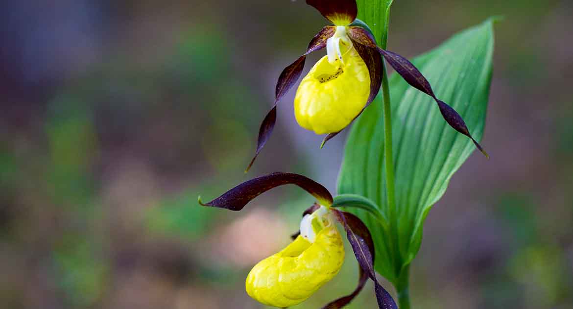
In the environment that is very calcareous and moist, many rare animals and plants live. Here are a lot of orchids, such as Guckuskoe, meadow keys, forest bud and spider flowers.

From the northern entrance there is a ramp up to one of the three bird towers that are set up, where you can spot the birds that come and rest in the reserve. The two lakes are connected by a sign posted approximately 7 km long path.

Find your way here!

There are three entrances to choose from.
North: follow the E14 west from Östersund, turn right at the Ås cross and drive towards Kännåsen. Road signs show the way to the parking lot.

South: follow Tysjövägen in Lugnvik until the end.

West: follow the road E14 west from Östersund, five kilometers from the town there is a long exit with a rest area.

By bus: From Östersund bus station you can get to Lugnvik by bus no: 6 and 8, at the terminals Bofinkvägen, Lövsångarvägen there is then a sidewalk that goes under E14 up to Tysjövägen.

Ändsjön

At Frösön lies the nature reserve Ändsjön which is Frösön’s only lake. The lake is surrounded by both agricultural land and residential areas.

Show more

cykla

Andersön

Andersön is a popular place were families, exercisers and others who would like to recharge their batteries and calm down for a while goes.

Show more

Tysjöarna

Make a nice excursion to Tysjöarna’s Nature Reserve, which is just outside Östersund’s center.

Show more

St. Olavsleden

3 proposals for sections of the S: t olavsleden located near Östersund. St. Olavsleden, the world’s northernmost trail of pilgrim runs through Östersund. The trail is about 580 kilometers long, starts in Selånger outside Sundsvall and extends to Trondheim in Norway. It is possible to hike stages of the trail, starting from Östersund.

Brunflo-Östersund

To start your hike from Brunflo to Östersund, is a day stage of 15.2 km. The trail mostly runs along lake Storsjön with a view of the Oviksfjällen.

Brunflo has a 30 meter high castle, a defense tower from the 12th century, which was consecrated to St. Olav. The name Brunflo means the well by the bog and at Lövberget is St. Olav’s spring. Odensalakärret is rich in orchids and is located next to St. Olavsleden, three kilometers from Östersund.

Due to the calcareous water, purple bundle root with dark purple and vanilla-scented flowers thrives. Marked paths and ridges run between fly flowers, bridal spurs and dicotyledons.

Östersund is the only city in Jämtland County, and was founded in 1786 by Gustav III. Make a visit to Jamtli, which is a living historical land where in the summer you meet contemporary authors in the farms/houses who tell about life in the old days.

More info on the pilgrim trail St. olavsleden

S:t Olavsleden Östersund

Östersund-Frösö Church

Follow the pilgrimage trail a short distance from Östersund-Frösö church. A distance where you can feel what it is like to walk along the trail, 7 km.

Start your hike in Badhusparken, from there you follow the red trail markings, they take you over to the island Frösön. From here, the hike continues along Storsjön. On Frösön, the Runestone are a historical sight to take part in.

When you have reached the Trinity Source, the hike continues towards Ändsjön nature reserve and further up towards Frösö Church. When you reach the Church, take the opportunity and enjoy the fantastic view of lake Storsjön and the mountain world.

More info on the pilgrim trail St. olavsleden

Frösö Church-Rödö Church

From Frösö church you can walk on towards Rödö church and on the way stop at the ancient monument Tibrandshögarna, after you cross the Rödö bridge.

From Frösö church to Rödökyrka it is a walk of about: 10 km. Frösö church from the 13th century was built with St. Olav as the patron saint.

In summer, the drama Arnljot is played next door. It is about the Viking from Gällö who fought with St. Olav in Stiklestad.

Cross the bridge to Rödön with the ancient monument Tibrandshögarna from the 14th century.

Listen to the waves and look for the Great Lake monster (Storsjöodjuret), which is said to live in the lake’s deep caves.
Rödön’s church is from the Middle Ages and was lavishly decorated after a fire in the 1920s.
The hike contains strawberry and potato plantations.

More info on the pilgrim trail St. olavsleden

Brunflo-Östersund

To start your hike from Brunflo to Östersund, is a day stage of 15.2 km. The trail mostly runs along lake Storsjön with a view of the Oviksfjällen.

Show more

S:t Olavsleden Östersund

Östersund-Frösö Church

Follow the pilgrimage trail a short distance from Östersund-Frösö church. A distance where you can feel what it is like to walk along the trail, 7 km.

Show more

Frösö Church-Rödö Church

From Frösö church you can walk on towards Rödö church and on the way stop at the ancient monument Tibrandshögarna, after you cross the Rödö bridge.

Show more

Three flower walks

Jämtland and the area around Storsjön offer fantastic conditions for the beautiful and protected orchids thanks to their calcareous soil. Here are tips on some flower excursions close to nature.

Odensalakärret

Just 3 km from the center of Östersund in, Odensala area is the Odensalakärret nature reserve. Here are the orchids with fantastic colors and shapes.

In June and July the orchids bloom the most.
Just 3 km from the center of Östersund in the Odensala area is this very calcareous and wet area of ​​4 hectares, a swamp. Thanks to the fact that there is so much lime in the water, there are special flowers and other plants here. Take a bus from the center of Östersund towards Odensala and get off at Tavelbäcken. The reserve is located on the slope down to Storsjön in Odensala. Follow Tavelbäcksvägen down towards Orkidégången or Kärrvägen until the end.

Find your way here!

Vikekärret

A unique place for all orchid fans! You should go here in June to look at all the fantastic orchids that bloom in the calcareous soil.

You should go here in June to look at all the fantastic orchids that bloom in the calcareous soil. Some years it is literally boiled by Guckusko. In addition to Guckusko you can find a lot of other orchids.

The area is easily accessible and after a few hundred meters walk from the car through the forest you come out to the area which gives a strong Gotland feeling.

Find your way here!

Nästmyren Fugelsta

Nästmyren Fugelsta consists of an open meadow and is located on the coniferous forests above the cultivated landscape in Fugelsta and Marieby.

Nästmyren Fugelsta consists of an open meadow and is located on the coniferous forests above the cultivated landscape in Fugelsta and Marieby by Storsjön, about nine kilometers southeast of the center of Östersund.

If you cross the bridge Vallsundsbron and turn left towards Marieby and about 100 m before the church at Marieby, you turn up to Brunkulla’s car park. The flora is rich in species and the area has a rich occurrence of the red-listed orchid lignite. There are also a number of other species that are typical of natural hayfields and pastures.

Field gentian and meadow gentian grow in abundance. Jämtland dandelion, trembling grass, bridal spur, dicotyledonous and cranberry are other species that adorn the well-developed grass soap. The rare butterfly species violet goldenwing also occurs in the area.

Odensalakärret

Just 3 km from the center of Östersund in, Odensala area is the Odensalakärret nature reserve. Here are the orchids with fantastic colors and shapes.

Show more

Vikekärret

A unique place for all orchid fans! You should go here in June to look at all the fantastic orchids that bloom in the calcareous soil.

Show more

Nästmyren Fugelsta

Nästmyren Fugelsta consists of an open meadow and is located on the coniferous forests above the cultivated landscape in Fugelsta and Marieby.

Show more

City Walks

From the center of Östersund you can find many nice walking paths. If you are only here visiting during the day, you can find some suggestions here where you have time to experience most of Östersund’s surroundings.
Discover Östersund on foot!

Campus A4

The campus is close to the center. A walk in the area can be combined with looking at works of art and reading about historical military events.

A4 Campus, is a combination of the old and the new and tells about the transition from soldiers to students. A4 stands for Norrland’s Artillery Regiment, the first Norrland Artillery Regiment and the first regiment of three in Östersund.

Today, Campus is a new-old district in the middle of Östersund and consists of workplaces for about 1,400 people from private companies, organizations, schools and government agencies.
At the same time, the area is a modern university area with 7,000 students in a historic site with military buildings from the end of the 19th century. A walk in the Campus area can be combined with looking at works of art and reading about historical events from the regimental period.

Read more!

Campus Östersund

Hälsans Stig

A large part of the path runs along Storsjön and passes Göviken and Badhusparken and on to Jamtli and much else worth seeing along the way.

Around Sweden there are 130 Hälsans stig (path), easily accessible and well-signposted walking paths. Common to the trails is that they are easy to get to and go in a loop that is usually between 3 and 6 kilometers. The path of health makes it easier for everyone to reach the public health goal of moving at least 30 minutes a day.
The first Health Path was established in Ireland in 1995 by Irish Heart, the Irish Heart Fund. Slí na Sláinte means “path to health” and its purpose is to promote exercise at all ages and to prevent cardiovascular disease. Today, Hälsan’s path is found in more than ten countries in Europe and North America. In Sweden, the Riksförbundet HjärtLung owns the concept, but it is the municipality that creates and manages the Health Path.

Map and link to Hälsans Stig in Östersund below:

Nature map!

Badhusparken

cykelstig

Minnesgärdet

Walk from the center along Storsjöstrand to Minnesgärdet, here you get a wonderful feeling of the city's proximity to Storsjön and the mountains.

Start at Badhusparken and walk east past the marina, continue a walking path along the water and the newly built area Storsjöstrand. Then you walk along the water and the old road Storsjöstråket to Minnesgärdet, a distance of about: 2.8 km.

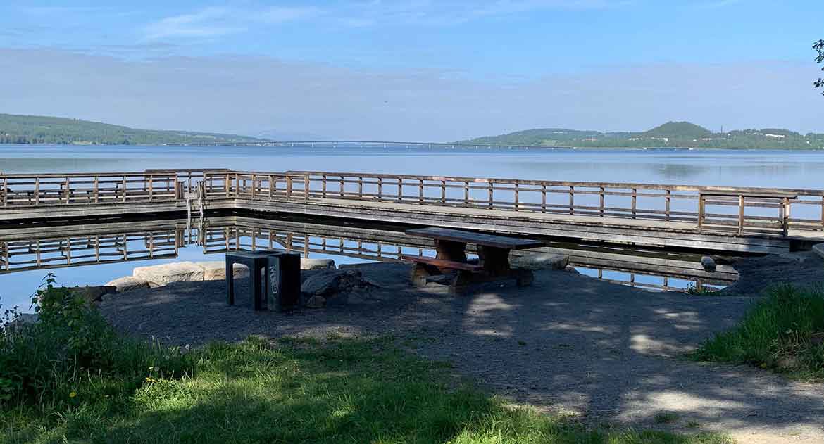
Either you choose to turn back the same way or continue on a nice walk that still goes along the water more like a path towards Odensala. Along this road there are many nice picnic areas, piers, barbecue areas and with beautiful views of Storsjön and Oviksfjällen.

Campus A4

The campus is close to the center. A walk in the area can be combined with looking at works of art and reading about historical military events.

Show more

Hälsans Stig

A large part of the path runs along Storsjön and passes Göviken and Badhusparken and on to Jamtli and much else worth seeing along the way.

Show more

cykelstig

Minnesgärdet

Walk from the center along Storsjöstrand to Minnesgärdet, here you get a wonderful feeling of the city's proximity to Storsjön and the mountains.

Show more